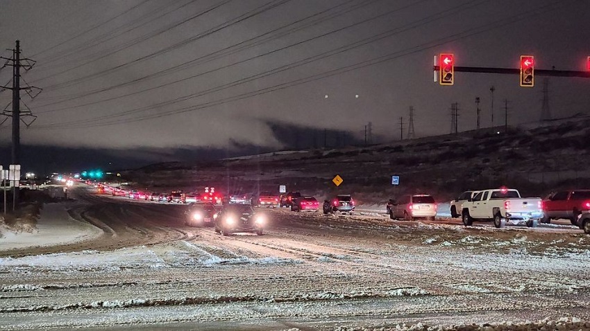
Ogden, UT — Northern Utah’s roadways were met with heavy, slushy snow Thursday morning, creating slow and slippery driving conditions for commuters. While the winter storm is beneficial for the state’s snowpack, it has made for a challenging start to the day for those on the roads.
Just after 7 a.m., the Utah Department of Transportation (UDOT) reported no significant crashes in northern Utah, but traffic monitors showed weather-related slowdowns from Centerville to Layton. The UDOT issued a warning about the impacts of heavy snow in the urban corridor from Salt Lake City to Ogden and Brigham City, particularly in bench areas, where snow accumulation is expected to be the heaviest.
According to UDOT, while snow may not be as intense in areas south of Salt Lake City, widespread slick and slushy conditions are anticipated. Bench areas, known for their higher elevations, are likely to experience the most significant snowfall, further complicating travel.
For those planning to travel throughout Utah, the following roads have been identified by UDOT as areas expected to face weather-related issues:
- I-15: Idaho border to Cove Fort/I-70 junction
- I-215: Entire route
- I-80: Delle to Wyoming border
- I-84: Entire route
- I-70: Cove Fort/I-15 junction over Clear Creek Summit
- US-40: I-80 junction over Daniels Summit to Fruitland
- US-6: I-15 to Helper, through Spanish Fork Canyon and over Soldier Summit
- US-89: Idaho border to Mt. Pleasant
- US-91: Entire route
- US-189: Provo Canyon
- US-191: Over Indian Canyon Summit and north of Vernal
- SR-190: Big Cottonwood Canyon
- SR-210: Little Cottonwood Canyon
- SR-224: Entire route
- SR-248: Entire route
- SR-158: Powder Mountain
- SR-167: Trappers Loop
- SR-226: Snowbasin
- SR-39: Entire route
- SR-16: Entire route
- SR-35: Francis to Wolf Creek Pass gate
- SR-31: Entire route
- SR-30: Entire route
- SR-28: Entire route
- SR-132: Entire route
- SR-36: Entire route
- SR-153: Entire route
The morning commute is expected to be the most heavily impacted, with travel likely improving as temperatures rise throughout the day. Warming conditions should help reduce road snow accumulation, though residual slush could still present challenges, particularly north of Salt Lake County.
As the storm moves through, UDOT urges drivers to use extra caution and plan for additional travel time, especially in higher elevation areas where snow and slush can cause unpredictable conditions.

